
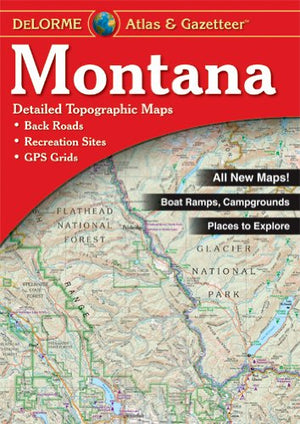
{"id":298035609641,"title":"Montana Atlas \u0026 Gazetteer","handle":"atlas-gazetteer-montana","description":"\u003cdiv class=\"short_description\"\u003eWith an incredible wealth of detail, DeLorme's\u003cspan\u003e \u003c\/span\u003e\u003cem\u003eAtlas \u0026amp; Gazetteer\u003c\/em\u003e\u003cspan\u003e \u003c\/span\u003eis the perfect companion for exploring the Montana outdoors. Extensively indexed, full-color topographic maps provide information on everything from cities and towns to historic sites, scenic drives, trailheads, boat ramps and even prime fishing spots.\n\u003cp\u003eWith a total of 80 map pages, the\u003cspan\u003e \u003c\/span\u003e\u003cem\u003eAtlas \u0026amp; Gazetteer\u003c\/em\u003e\u003cspan\u003e \u003c\/span\u003eis your most comprehensive navigational guide to Montana's backcountry.\u003c\/p\u003e\n\u003c\/div\u003e\n\u003cdiv class=\"description\"\u003e\n\u003cul\u003e\n\u003cli\u003eFull-color topographic maps provide information on everything from cities and towns to historic sites, scenic drives, recreation areas, trailheads, boat ramps and prime fishing spots\u003c\/li\u003e\n\u003cli\u003eExtensively indexed\u003c\/li\u003e\n\u003cli\u003eHandy latitude\/longitude overlay grid for each map allows you to navigate with GPS\u003c\/li\u003e\n\u003cli\u003eInset maps provided for major cities as well as all state lands\u003c\/li\u003e\n\u003c\/ul\u003e\n\u003c\/div\u003e","published_at":"2017-11-24T14:58:18-07:00","created_at":"2017-11-24T14:59:37-07:00","vendor":"Anglers Book Supply","type":"Books\/Maps","tags":["Books","Type_Maps"],"price":2495,"price_min":2495,"price_max":2495,"available":false,"price_varies":false,"compare_at_price":null,"compare_at_price_min":0,"compare_at_price_max":0,"compare_at_price_varies":false,"variants":[{"id":4140230148137,"title":"Default Title","option1":"Default Title","option2":null,"option3":null,"sku":"1-946494-78-X","requires_shipping":true,"taxable":true,"featured_image":null,"available":false,"name":"Montana Atlas \u0026 Gazetteer","public_title":null,"options":["Default Title"],"price":2495,"weight":227,"compare_at_price":null,"inventory_quantity":0,"inventory_management":"shopify","inventory_policy":"deny","barcode":"753759182212","requires_selling_plan":false,"selling_plan_allocations":[]}],"images":["\/\/eastrosebudflyandtackle.com\/cdn\/shop\/products\/51pek7CUKAL.jpg?v=1574387442"],"featured_image":"\/\/eastrosebudflyandtackle.com\/cdn\/shop\/products\/51pek7CUKAL.jpg?v=1574387442","options":["Title"],"media":[{"alt":"Atlas \u0026 Gazetteer Montana - East Rosebud Fly and Tackle","id":604633202787,"position":1,"preview_image":{"aspect_ratio":0.708,"height":500,"width":354,"src":"\/\/eastrosebudflyandtackle.com\/cdn\/shop\/products\/51pek7CUKAL.jpg?v=1574387442"},"aspect_ratio":0.708,"height":500,"media_type":"image","src":"\/\/eastrosebudflyandtackle.com\/cdn\/shop\/products\/51pek7CUKAL.jpg?v=1574387442","width":354}],"requires_selling_plan":false,"selling_plan_groups":[],"content":"\u003cdiv class=\"short_description\"\u003eWith an incredible wealth of detail, DeLorme's\u003cspan\u003e \u003c\/span\u003e\u003cem\u003eAtlas \u0026amp; Gazetteer\u003c\/em\u003e\u003cspan\u003e \u003c\/span\u003eis the perfect companion for exploring the Montana outdoors. Extensively indexed, full-color topographic maps provide information on everything from cities and towns to historic sites, scenic drives, trailheads, boat ramps and even prime fishing spots.\n\u003cp\u003eWith a total of 80 map pages, the\u003cspan\u003e \u003c\/span\u003e\u003cem\u003eAtlas \u0026amp; Gazetteer\u003c\/em\u003e\u003cspan\u003e \u003c\/span\u003eis your most comprehensive navigational guide to Montana's backcountry.\u003c\/p\u003e\n\u003c\/div\u003e\n\u003cdiv class=\"description\"\u003e\n\u003cul\u003e\n\u003cli\u003eFull-color topographic maps provide information on everything from cities and towns to historic sites, scenic drives, recreation areas, trailheads, boat ramps and prime fishing spots\u003c\/li\u003e\n\u003cli\u003eExtensively indexed\u003c\/li\u003e\n\u003cli\u003eHandy latitude\/longitude overlay grid for each map allows you to navigate with GPS\u003c\/li\u003e\n\u003cli\u003eInset maps provided for major cities as well as all state lands\u003c\/li\u003e\n\u003c\/ul\u003e\n\u003c\/div\u003e"}
Montana Atlas & Gazetteer


Related Products
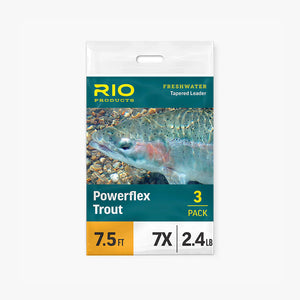
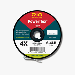
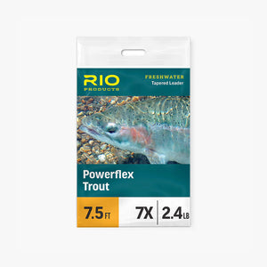
Rio Powerflex Tippet
From
$5.50


Slotted Tungsten Beads
From
$8.95

Plummeting Tungsten Beads (1/8" - 7/32")
From
$7.95
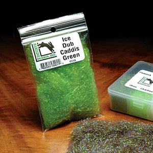
Ice Dub
$3.95
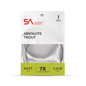
Scientific Anglers Absolute Trout Leaders
From
$8.95


ERFT Gift Card
From
$10.00
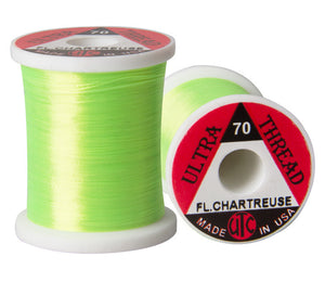
UTC 70 Denier Thread
$2.95

Uni Thread
From
$4.30