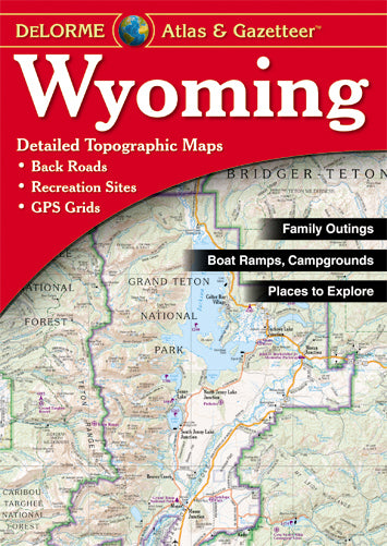
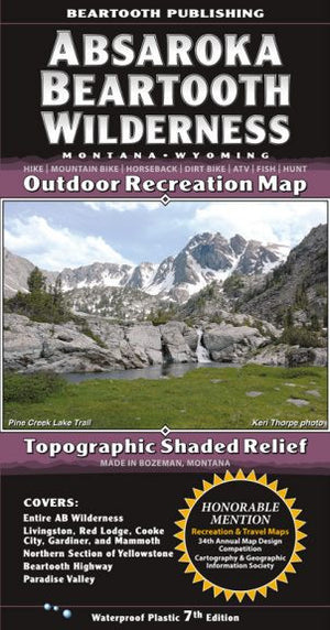
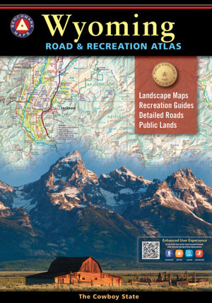
{"id":298038919209,"title":"Atlas \u0026 Gazetteer - Wyoming","handle":"atlas-gazetteer-wyoming","description":"\u003cdiv class=\"short_description\"\u003eWith an incredible wealth of detail, DeLorme's\u003cspan\u003e \u003c\/span\u003e\u003cem\u003eAtlas \u0026amp; Gazetteer\u003c\/em\u003e\u003cspan\u003e \u003c\/span\u003eis the perfect companion for exploring the Wyoming outdoors. Extensively indexed, full-color topographic maps provide information on everything from cities and towns to historic sites, scenic drives, trailheads, boat ramps and even prime fishing spots.\n\u003cp\u003eWith a total of 60 map pages, the\u003cspan\u003e \u003c\/span\u003e\u003cem\u003eAtlas \u0026amp; Gazetteer\u003c\/em\u003e\u003cspan\u003e \u003c\/span\u003eis your most comprehensive navigational guide to Wyoming's backcountry.\u003c\/p\u003e\n\u003c\/div\u003e\n\u003cdiv class=\"description\"\u003e\n\u003cul\u003e\n\u003cli\u003eFull-color topographic maps provide information on everything from cities and towns to historic sites, scenic drives, recreation areas, trailheads, boat ramps and prime fishing spots\u003c\/li\u003e\n\u003cli\u003eExtensively indexed\u003c\/li\u003e\n\u003cli\u003eHandy latitude\/longitude overlay grid for each map allows you to navigate with GPS\u003c\/li\u003e\n\u003cli\u003eInset maps provided for Yellowstone National Park, major cities as well as all state lands\u003c\/li\u003e\n\u003c\/ul\u003e\n\u003c\/div\u003e","published_at":"2017-11-24T14:59:49-07:00","created_at":"2017-11-24T15:01:10-07:00","vendor":"Anglers Book Supply","type":"Books\/Maps","tags":["Books","Type_Maps"],"price":2495,"price_min":2495,"price_max":2495,"available":true,"price_varies":false,"compare_at_price":null,"compare_at_price_min":0,"compare_at_price_max":0,"compare_at_price_varies":false,"variants":[{"id":4140234014761,"title":"Default Title","option1":"Default Title","option2":null,"option3":null,"sku":"","requires_shipping":true,"taxable":true,"featured_image":null,"available":true,"name":"Atlas \u0026 Gazetteer - Wyoming","public_title":null,"options":["Default Title"],"price":2495,"weight":227,"compare_at_price":null,"inventory_quantity":1,"inventory_management":"shopify","inventory_policy":"continue","barcode":"753759194680","requires_selling_plan":false,"selling_plan_allocations":[],"quantity_rule":{"min":1,"max":null,"increment":1}}],"images":["\/\/eastrosebudflyandtackle.com\/cdn\/shop\/products\/0899333389_1__28785.1452107532.jpg?v=1574387488"],"featured_image":"\/\/eastrosebudflyandtackle.com\/cdn\/shop\/products\/0899333389_1__28785.1452107532.jpg?v=1574387488","options":["Title"],"media":[{"alt":"Atlas \u0026 Gazetteer Wyoming - East Rosebud Fly and Tackle","id":604635365475,"position":1,"preview_image":{"aspect_ratio":0.709,"height":501,"width":355,"src":"\/\/eastrosebudflyandtackle.com\/cdn\/shop\/products\/0899333389_1__28785.1452107532.jpg?v=1574387488"},"aspect_ratio":0.709,"height":501,"media_type":"image","src":"\/\/eastrosebudflyandtackle.com\/cdn\/shop\/products\/0899333389_1__28785.1452107532.jpg?v=1574387488","width":355}],"requires_selling_plan":false,"selling_plan_groups":[],"content":"\u003cdiv class=\"short_description\"\u003eWith an incredible wealth of detail, DeLorme's\u003cspan\u003e \u003c\/span\u003e\u003cem\u003eAtlas \u0026amp; Gazetteer\u003c\/em\u003e\u003cspan\u003e \u003c\/span\u003eis the perfect companion for exploring the Wyoming outdoors. Extensively indexed, full-color topographic maps provide information on everything from cities and towns to historic sites, scenic drives, trailheads, boat ramps and even prime fishing spots.\n\u003cp\u003eWith a total of 60 map pages, the\u003cspan\u003e \u003c\/span\u003e\u003cem\u003eAtlas \u0026amp; Gazetteer\u003c\/em\u003e\u003cspan\u003e \u003c\/span\u003eis your most comprehensive navigational guide to Wyoming's backcountry.\u003c\/p\u003e\n\u003c\/div\u003e\n\u003cdiv class=\"description\"\u003e\n\u003cul\u003e\n\u003cli\u003eFull-color topographic maps provide information on everything from cities and towns to historic sites, scenic drives, recreation areas, trailheads, boat ramps and prime fishing spots\u003c\/li\u003e\n\u003cli\u003eExtensively indexed\u003c\/li\u003e\n\u003cli\u003eHandy latitude\/longitude overlay grid for each map allows you to navigate with GPS\u003c\/li\u003e\n\u003cli\u003eInset maps provided for Yellowstone National Park, major cities as well as all state lands\u003c\/li\u003e\n\u003c\/ul\u003e\n\u003c\/div\u003e"}
Atlas & Gazetteer - Wyoming


Related Products
Beartooth Mountain Range Map
$14.95
Sold Out
Absaroka Mountain Range Map
$14.95
Sold Out
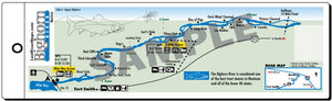
Bighorn Upper River Map
$7.95
Sold Out
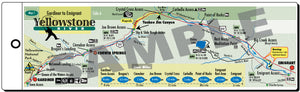
Yellowstone River Map
$7.95
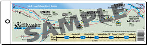
Stillwater River Map
$7.95
Sold Out
Sold Out
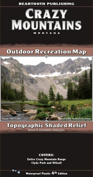
Crazy Mountain Range Map
$14.95
Sale

Barr Flies - John Barr
$23.95
$39.95
Sold Out

Bighorn Lower River Map
$7.95